Where did all the Service Stations go?
Updated April 15, 2026
See the lists*
Neighborhood service stations have all but disappeared from Queen Anne since I moved here in 1985. Their loss has radically altered the landscape, transforming what was once a quasi-suburban place into a much more intensely urban one. The reasons for this dramatic shift have included environmental policies, new forms of urban displacement, dynamic economic issues and improvements in the design of automobiles.
In the 1980s, when my car got a flat tire, I’d simply roll the wheel down the block to my service station to get the leak plugged or buy a new tire. Those were the days before I worried about global warming, before I commuted by bus and bike, and when I still resented paying more than 25¢ for a gallon of gas.
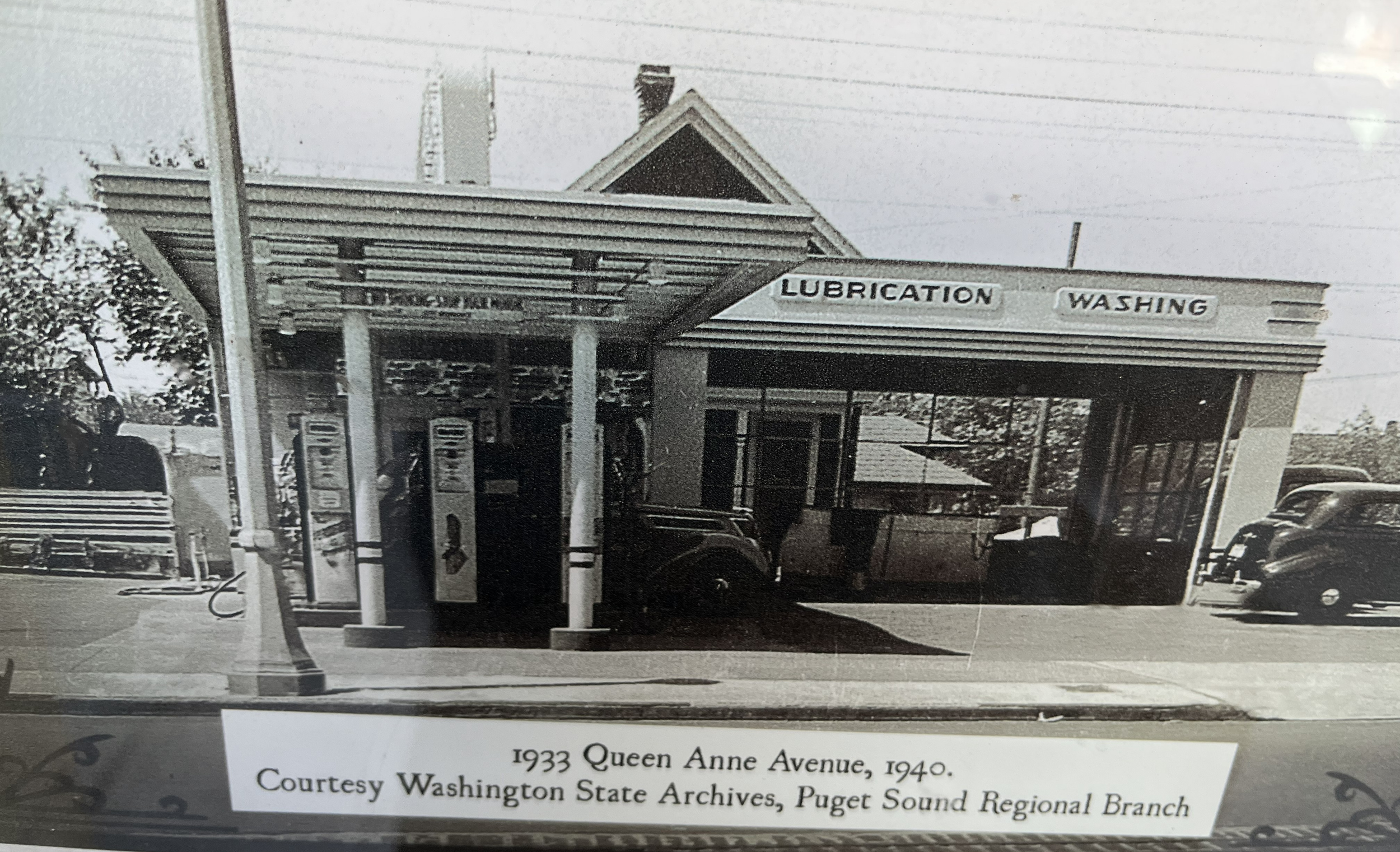
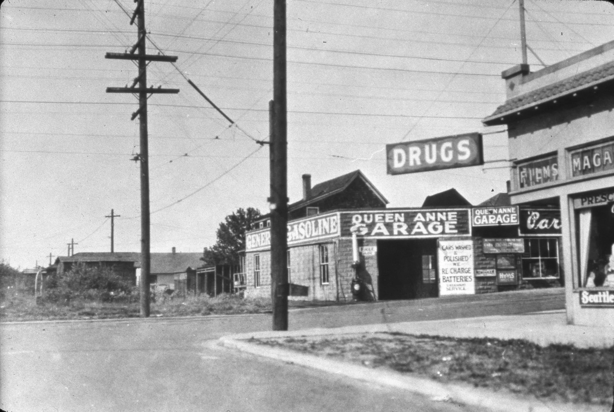
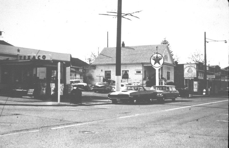
Looking west, gas station at 1933 Queen Anne N. at Crockett. Photo: See label above. Photo and label are visible in front of the CVS Pharmacy now on the site.
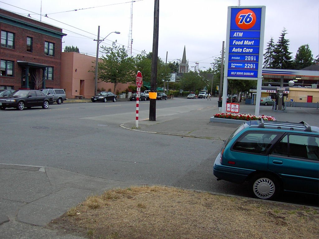
Looking south along Queen Anne N at Crockett, station on the right. Photo: Picture Perfect Queen Anne. 2004.
We all know the site of my service station at Crockett Street. Big Max and Bartell (now a CVS) are there. In addition to the service station, which we also called the gas station, the entire west side of the block from Crockett to Howe consisted of former homes and odd one-story buildings out in front. Helen’s salon hair at Howe is the only vestige of that period before the Growth Management Act of 1990 and the multifamily housing boom on Queen Anne Ave.
Naturally, I never filled my tank myself. Either a bright-eyed teenage boy (always a boy) or the station owner would come out and fill ‘er up. I knew the station closed at a reasonable hour, but in my heart, it was always open. Truth to tell, I recall struggling a flat or two back to my house after discovering the garage doors rolled down.
Like most American service stations, the one at 1933 Queen Anne Ave N occupied about two urban lots which except for the one-story rectangular building were entirely paved with asphalt. The building consisted of three bays. Two of them had roll-up doors on the front and the back. My Crockett St station had a wide single roll up door. Many stations had hydraulic lifts that made working under cars easy while others had pits where mechanics could descend under vehicles. The third bay consisted of a small office in the front with storage behind it. The gas pumps stood on an island out in front and were connected to the building by a roof that shielded attendants, pumps, and cars from the weather. The sign you can’t see on the roof in the photo reads Richfield, the brand of gas sold there. By 2004, it had been remodeled and sold 76 brand gasoline.
All these stations shared many features. They all had a large sign on a pole or over the station roof proclaiming their brand: Shell, Exxon, Sinclair, Chevron, Esso, Texaco, Richfield or even Gull, a local one. I still love the flying Pegasus on the Mobil stations. The simple gas station building had concrete or cinder block walls frequently clad with white metal panels for easy cleaning. They came in every style: Colonial Revival, Greek Revival, Art Deco and Modern among others. It is no surprise that no one ever saw or gave much thought to the most distinctive feature every one of them shared.
Hidden under those broad swaths of asphalt lay massive 10,000-gallon tanks storing gasoline waiting to be pumped. There probably wasn’t one tank in all of Seattle that didn’t leak, contaminating the soil surrounding the building, often beyond the property line. Nearly all the stations were owned by individual mechanics or entrepreneurs. For sure, the nickel and dime aspect of gas station work contributed to their disappearance, but the cost of replacing those tanks and remediating the soil is what really drove them out of business.
While the National Environmental Policy Act signed on January 1, 1970, by President Richard M. Nixon of Watergate fame, started the ball rolling, remediation of all those pollutants required additional legislation from the states. The cost of removing tanks and cleaning up the contaminated soil was daunting and took a long time. Many of the lost stations listed below still pumped gas when I arrived in the neighborhood in 1985.
The soil at the bottom of Queen Anne was so bad the city was able to acquire Counterbalance Park (northeast corner of Roy and Queen Anne N) at almost no cost. The city sealed the polluted land with a concrete lid and in 2008 created a new open space on top of it. The absence of plants except in raised beds hints at what lies below the concrete slab. The new park also obliterated access to the tunnel where the concrete block of the counterbalance may still be hiding. The site across the street (southwest corner Roy and Queen Anne N) also had a service station. It lay dormant for years and required huge sums of money to mitigate the polluted soil under it and the Del Roy Apartments to the west.
The intersection of Galer Street and Queen Anne had a concentration of service stations. I count six of them within a block of that busy and now redesigned corner! The Galer Crest at 1420 Queen Anne N sheltered one of them, while the building across from it which follows the curve from Queen Anne to Galer held a classy suburban style gas station whose glass walls remind me of Philip Johnson’s 1949 home in Connecticut or Mies Van Der Rohe’s 1951 Farnsworth House in Illinois.
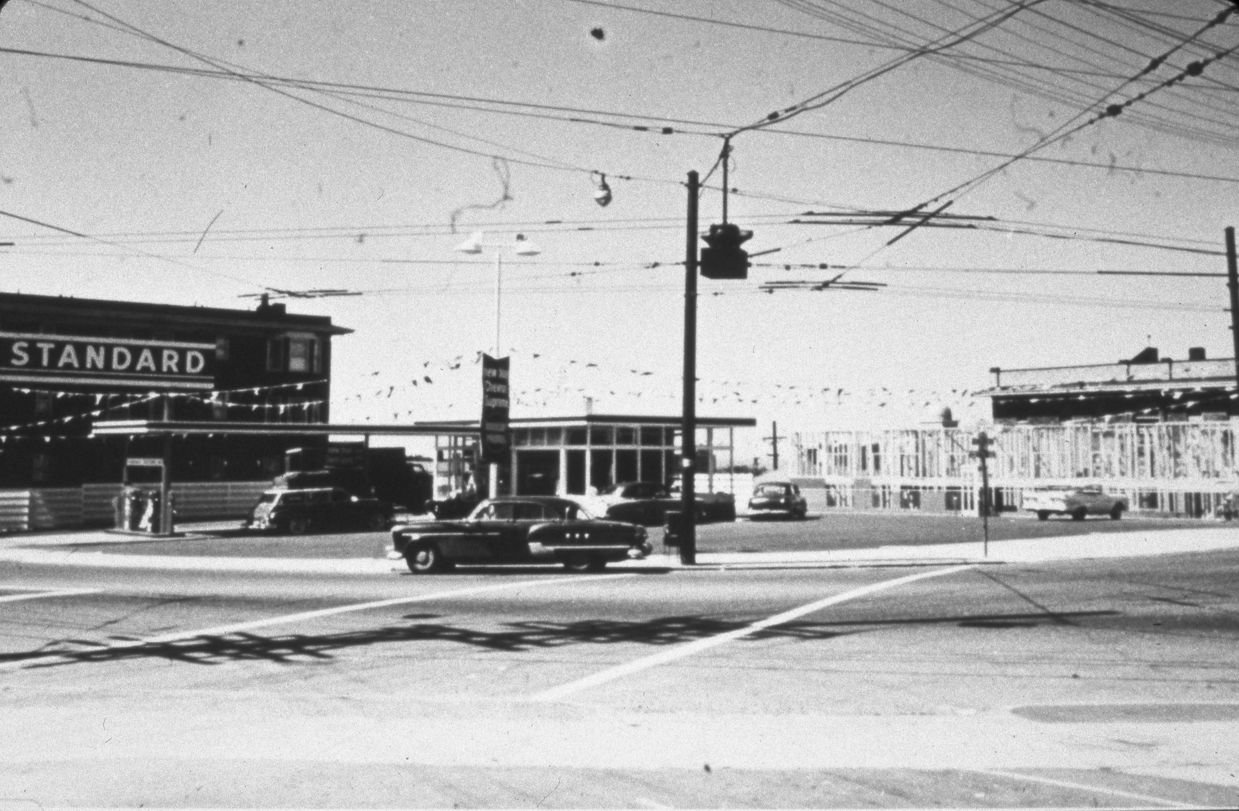
Texaco at Galer and Queen Anne Ave N in 1958. Looking southwest. Photo: QAHS Collections.
Following its demolition, my son Aram helped friends run a Christmas tree lot there in the 1990s. The MarQueen Garage at 1506 Queen Anne N also pumped gas as early as 1920. The plugged holes in front of the garage prove it. The place across the street at 1523 Queen Anne N called the Queen Anne Garage also pumped gas (1934 City Directory).
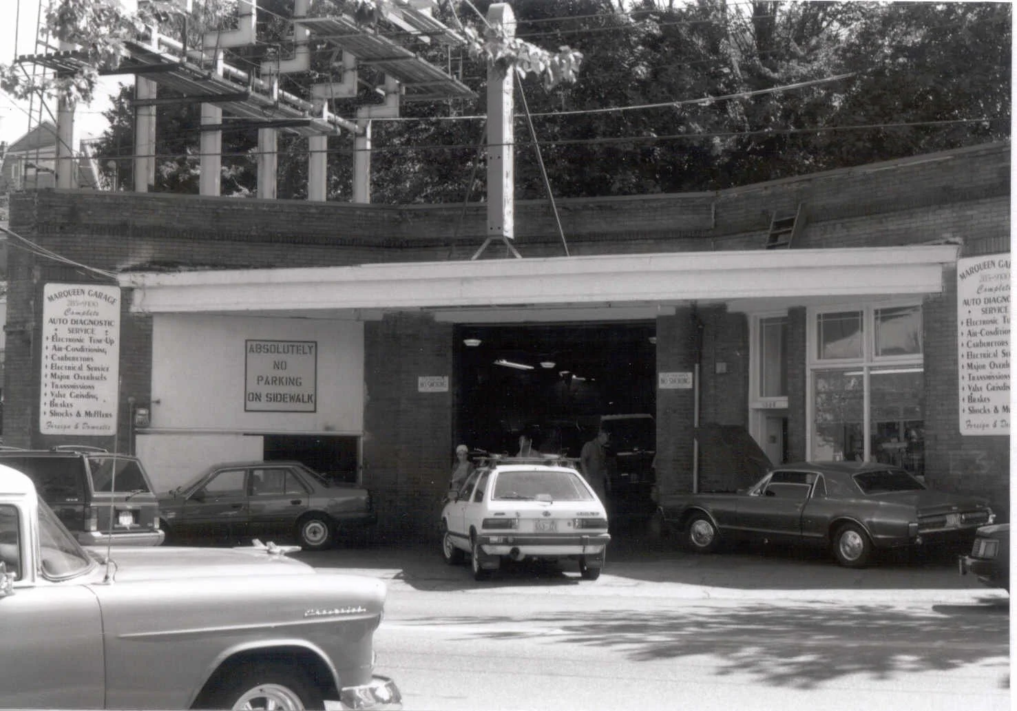
MarQueen Garage. Gas pump formerly located beside car on the right. Looking east. Photo: Seattle Historical Building Survey 2001.
Galer Crest is one of Queen Anne’s largest multi-family buildings. Built in 1930, it is a mixed-use building. One use was an auto repair garage. The driveway that slips under the building’s western edge and the forlorn island with missing gas pumps at the sidewalk reveal it was a full-fledged service station. Tucked behind the driveway, the cute little office in the center of the drive repeats the shops in the later freestanding gas stations.
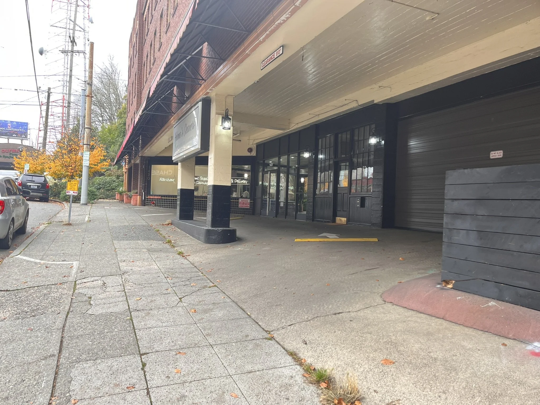
1420 Queen Anne N, Galer Crest. Gas pump island and driveway. Looking north. Photo: QAHS 2025.
This building offers an urban version of a service station while the one across the street from it and my Crockett St favorite were more suburban in spirit. I’ll leave it to future historians to dig up whatever happened to the tanks or the soil under Galer Crest.
Neighbors remind me that Windermere’s offices on the northeast corner of W McGraw and Third Ave W replaced a station of the suburban type. The other day, a Queen Anne native revealed that the Queen CàPhe on the northwest corner of McGraw and Queen Anne N also served as a gas station.
In the morning of April 15, 2026, subsequent to the first publication of this piece, Mary Cole, a Queen Anne native, wrote to point out three additional stations. In the afternoon of the same day, she added one more. One of them was on the southwest corner of 1st Ave N. and Boston St where a portion of the Gables Apartment building now stands. We lost that station when the Safeway first went in about 50 years ago. Directly across the street the QA Eye Clinic was also a gas station. Among Mary’s gas station memories is the CVS at Queen Anne Ave and Mercer Street. The old Kidd Valley location with its swath of asphalt hid important clues to its automobile age use. Obviously, the building on the northeast corner of McGraw and Queen Anne Ave (Barg French Cleaners) was also one. The islands for the pumps are still visible in both surviving locations.
It astonishes me that our neighborhood has lost at least twenty (20!) service stations. Of the 20 I’ve either found in the 1931 and 1939 city directories or that I remember, only seven survive (one at Nickerson and Queen Anne N, one at Taylor and Aloha, two on Elliott, and three on Denny) and most of them are branded Shell. The station at the corner of Queen Anne and Denny is probably the oldest surviving service station. It appears in the 1931 city directory as Murray’s Super Service Station.
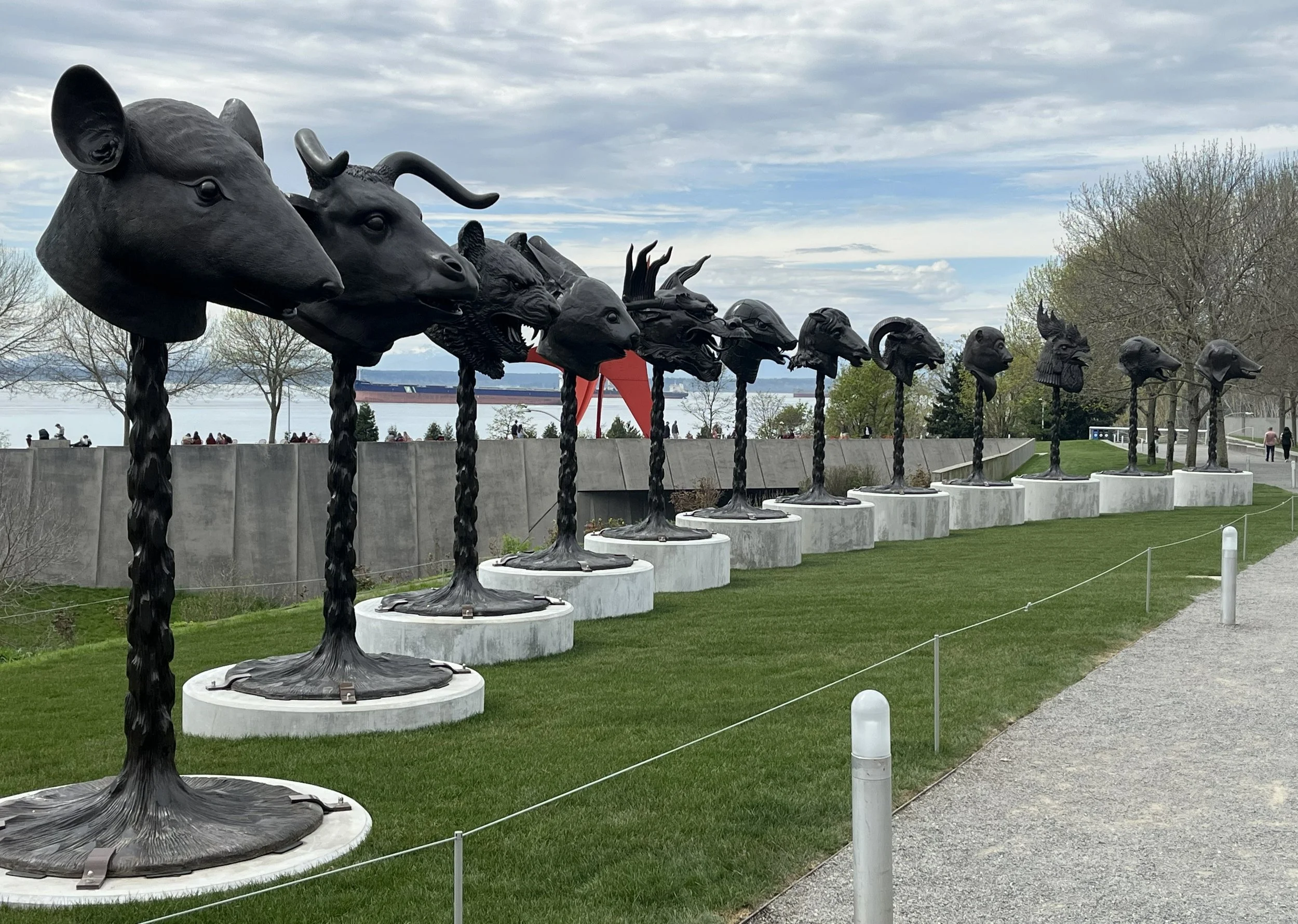
Olympic Sculpture Park looking northwest towards Circle of Animals/Zodiac Heads (Bronze), 2010, by Ai Weiwei (b. 1957) and installed week of March 30, 2026. Ai Weiwei reconstructed some of the heads for this installation. Photo: QAHS.
The Seattle site most polluted by gasoline and gasoline processing is the Olympic Sculpture Park, a superfund site on Elliott Bay at the base of Broad Street and just beyond the fringe of Queen Anne. According to a sign in the Paccar Pavilion in the park, it served from 1910 to 1975 as a petroleum distribution center for UNOCAL (Union Oil Company of California). In 2004, the expansion of the Seattle Art Museum on First Ave provided some 92,986 cubic yards of fill to bury the polluted land.
Alley at the Second W and W Galer. There’s a gas pump out front. This is now Anytime Gym. Looking northeast. Photo: QAHS Collections.
Texaco Station on the SE corner of W McGraw and 6th W. Looking southwest. Photo: QAHS Collections.

This Texaco survives on W Galer at Second W as Hobbs Hilltop Automotive. Looking southeast. QAHS. Dorpat Collection.
The loss of so many service stations dramatically changed the historic fabric of our neighborhood. Open space, lots of daylight and the 20th century sense of place disappeared. Some argue the loss is justified, but examples like Issaquah's repurposed station or Georgetown's Mini-Mart City Park prove otherwise.
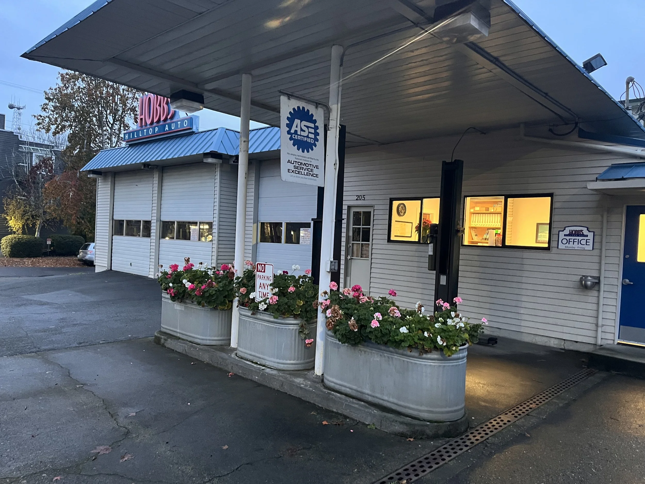
Hobbs Hilltop Automotive echoes its roots even with added bays on the east end and the floral tubs on the gas pump island. Looking southeast. Photo: QAHS 2025.
The passage of the state’s 1990 Growth Management Act and the Urban Village that resulted may have created markets for buildings large enough to mitigate the huge cost required for developers to clean up polluted places. Even so, the disappearance of service stations had nothing to do with protecting the environment, mitigating global warming, or electric cars, scooters, and bikes. Money or rather the lack of it is one solid reason. Another is the improved quality of cars, which simply do not break down as when I was a kid.
All these improvements aside, there is no way at nearly $6.00 per gallon you can say my 15-mile round trip to fill ‘er up at Costco #1 is climate friendly or cheap!
___________________________________________
*The Surely Incomplete List of Lost Service Stations
1. First W. at Mercer (NE Corner)
2. Second W at W Galer (NE corner, once Trader Joe’s, now Anytime Gym)
3. Second W at W Galer (SW corner. Exists; no gas now, Hobbs, Standard Oil)
4. Third W at McGraw (NE corner)
5. Galer Crest (1428 Queen Anne N) (east side)
6. W Galer at Queen Anne N (south side, Texaco)
7. W Crockett at Queen Anne N (SW corner)
8. W McGraw at Queen Anne N (SW corner)
9. W McGraw at 6th W (NW corner, Texaco)
10. Warren Ave N at Mercer St (NE corner)
11. W Roy at Queen Anne N (SW corner)
12. Roy at Queen Anne N (NE corner, Counterbalance Park)
13. 302 Nickerson (Peerless Service Station, south side of street)
14. 318 W Elliott (Standard Service Station)
15. 600 W Elliott (Allan M. Taylor Gas Station)
16. 717 W Elliott (Peck Wood and Coal Co., Inc. fuel and gas station)
17. 1506 15th W (Roy S. Loomis Gas Station)
18. 2004 15th W (Dragon Super Service Station)
19. 3820 15th W at Emerson (Canal Service Station)
20. 1506 Queen Anne N (MarQueen Garage survives, no gas)
Mary Cole’s list added 04/15/2026
20 Boston St. at 1st Ave N. SW Corner
21 Boston St. at 1st Ave N. NW Corner
2402 Queen Anne Ave N. at McGraw. NE Corner
CVS, 531 Queen Anne Ave N. SW Corner
List (Partial?) of Surviving Service Stations
1. Denny Way at Queen Anne N (NE corner, Shell)
2. Denny Way at Broad (NE corner Denny, Shell)
3. Denny Way at 7th Ave N (NW corner, Shell)
4. N Taylor Ave at Aloha (SE corner, Shell)
5. W Howe at 15th W (SE corner (Chevron)
6. 630 Elliott W (Shell)
7. 103 W Nickerson at Queen Anne N (Shell)